

2.2 3D Scanning: Potential and Challenges
This unit covers one of the methods for 3D recording; laser scanning. It will discuss the different types of 3D scanning and will explore through examples and case studies the potential and challenges of the method.
2.2.1 3D Scanning: Introduction
 |
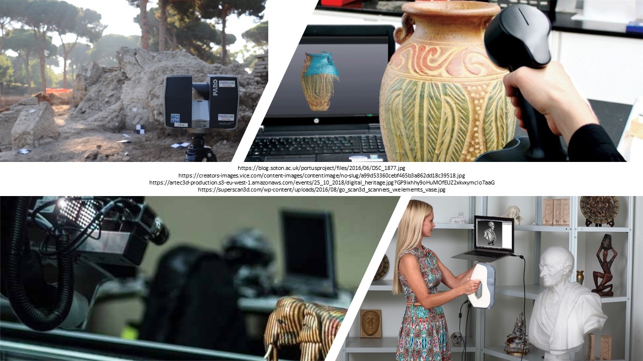
a 3D scanner is any device that collects 3D coordinates of a given region of an object surface, automatically and in a systematic way, at a high rate, and achieving results in real time.
 |
|
Different Types of 3D scanning devices (Click to Enlarge the figure) |
3D scanners operate under different principles, e.g. by emitting lasers or light patterns, and therefore go by mane names, including 3D digitisers, non-contact 3D digitisers, white light scanners, LIDAR (light detection and ranging) etc. In principle, any device that measures the physical world and can generate point clouds or polygon meshes (see quiz below) can be considered a 3D scanner. Since there are different methods to generate 3D data by measuring objects' real-world properties it is difficult to fully categorise them. However, Böehler and Marbs have come up with a graph that defines these methods based on the size of the object/feature to be measured and the number of measurements (complexity) required to fully capture its properties. The exercise below is based on that graph; it asks you to position the different scanning methods at the right place based on the object size and its complexity. Some of the terms used below will be unknown to you; try to guess based on the words used, e.g. a method that requires the involvement of a satellite most probably will not be for scanning small objects and/or those with low complexity. We will cover these in the following pages of the lesson.
 Exercise: Drag & Drop the 3D scanning methods to the right position
In the exercise above, you were introduced to various methodologies that can be used to capture three-dimensional information. It is worth mentioning though that 3D digitisers and 3D digitisation methods should not be considered panacea in dealing with objects. There are many reasons for that. Firstly, most of these approaches were not developed by or for cultural heritage. For example, 3D scanning devices are mostly used in engineering where the focus is on (somewhat regular) forms and shapes (geometry). In heritage studies, however, we are very much interested in things like small objects, big buildings, features with reflective surfaces, rough edges, as well as colour and minute texture details; However, it very challenging for such tools to capture all this amount and kind of three-dimensional information; most 3D scanners, for example have excellent capabilities and sub-millimetre accuracy when it comes to geometry but have less powerful tools/camera to accurately capture, e.g. colour. This is not because such expensive machines cannot include enhanced tools to precisely capture colour or texture, but because they were developed to mostly serve the needs of fields and sectors in which this information may not be critical. On the other hand, it should also be noted that there may be cases where a 3D digitisation approach may not be needed. It may be easier to take measurements by hand, if for example, you have a small object that is not very complex. If your work does not require a 3D model, then possibly a hand-drawn illustration or a photograph could suffice. Before deciding about a 3D digitisation method, it is always important to consider the cost of the investment (money, effort, skills) along with the size and complexity of the object, as well as its purpose and potential uses.
In the following pages and lessons, you will get more familiar with terms used in the context of 3D scanning. Earlier in the page we saw the term point cloud and polygon mesh. In the exercise above, you also so terms such as close-range and airborne photogrammetry, aerial and terrestrial surveys etc. The quiz below will help you understand and further clarify the terms. As a rule of thumb, most of these methods are named based on the distance of the object from the machine used for the digitisation; for example, close range photogrammetry is the method that uses a camera at a close distance from the photographed object. This means that objects may be anywhere from a few centimetres to a couple of meters far from the digitisation equipment used. Similarly, the term remote sensing or satellite remote sensing refers to the method of acquiring data remotely (without having contact with the object). This can make use of satellites or other aircraft-based (helicopter, drone etc.) sensor technologies. Take the quiz below to explore some of the basic terms used in 3D scanning methodologies.
 Quiz: 3D Scanning Terms
References
- Böhler, W. and Marbs, A. (2002). 3D Scanning Instruments, In Proceedings of CIPA WG6 Scanning for Cultural Heritage Recording. Institute for Spatial Information and Surveying Technology. Germany: University of Applied Sciences. https://goobi.tib.eu/viewer/image/830281592/12/
- Böhler, W., Bordas, M., Marbs, A. (2003). Investigating Laser Scanner Accuracy, In Altan, O. (ed.) Proceedings of the International Committee for Documentation of Cultural Heritage (CIPA’03) XIX International Symposium, pp. 696-702. https://www.cipaheritagedocumentation.org/wp-content/uploads/2018/11/Boehler-e.a.-Investigating-laser-scanner-accuracy.pdf
- Böhler, W. and Marbs, A. (2004). 3D Scanning and Photogrammetry for Heritage Recording: A Comparison, In Geospatial Information Research: Bridging the Pacific and Atlantic University of Gävle. Proceedings of the 12th International Conference on Geoinformatics, pp. 291-298. http://giscience.hig.se/binjiang/geoinformatics/files/p291.pdf
- Grussenmeyer, P., Landes, T., Doneus, M., & Lerma, J. L. (2016) Basics of range-based modelling techniques in Cultural Heritage 3D recording, In Remondino, F., Stylianidis, S., (eds), 3D Recording, Documentation and Management in Cultural Heritage, pp. 305-368. Dunbeath: Whittles. https://hal.archives-ouvertes.fr/hal-02319427/
- Jones, D. (2007). 3D Laser Scanning for Heritage. United Kingdom: English Heritage Publishing. https://historicengland.org.uk/images-books/publications/3d-laser-scanning-heritage/